
- +91 9503666660 / 9823123633
- ☰
- Home
- About Us
-
Products
Global Mapper Global Mapper Pro Digital Elevation Data Drone/UAV Agisoft Metashape
(Formerly known as PhotoScan) Surfer GEO5EnviroInsiteGeographic Calculator GMS | SMS | WMS MAPublisher Geographic Imager Final Builder- Services
- Contact
Golden Software Products
Schnell Informatics Pvt. Ltd. is the India Reseller for Surfer Software of Golden Software Inc and also for its other products.
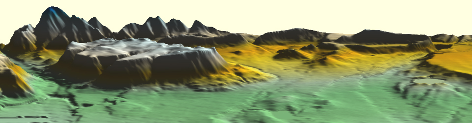
Surfer - Surface Modeling GIS Software
Surfer is a full-function 3D visualization, contouring and surface modeling package that runs under Microsoft Windows. Surfer is used extensively for terrain modeling, bathymetric modeling, landscape visualization, surface analysis, contour mapping, watershed and 3D surface mapping, gridding, volumetrics, and much more.
Features:
- Contour Maps
- Shaded Relief Maps
- Watershed Maps
- Map Layers
- Profiles
- Grid Node Editor
- Grid Functions
- 3D Surface Maps
- Base Maps
- 3D Wireframe Maps
- Stacking Maps
- Customize Your Map
- Variograms
- Using USGS and SRTM Data
- Image Maps
- Post Maps
- Vector Maps
- Map Projections
- Superior Gridding
- Faults and Breaklines
Who should use Surfer?
Hydrologists, engineers, geologists, archeologists, oceanographers, biologists, foresters, geophysicists, medical researchers, climatologists...
Grapher - Scientific graphing software
Grapher is the only graphing program you will ever need. Create powerful stunning graphs quickly and efficiently. Ideal for scientists, engineers, and business professionals.
Features:
- Grapher Overview
- Statistical Graph Types
- Contour and Surface Maps
- Axis Types
- Object and Property Manager
- Labels and Curve Filling
- Basic Graph Types
- Polar Graph Types
- Customize Your Graph
- Error Bars
- Worksheet Features
- Bar Graph Types
- Specialty Graphs
- Fit Curves
- Graph Wizard
- Automation
Voxler - 3D Well Data and Modeling Software
Voxler Create powerful, fast, customized 3D images of your data with Voxler 3. Easily import data in a multitude of file formats to create stunning models that visualize the relationships across your data set. This robust, yet user-friendly program gives you the power to display your data in a variety of formats and colors, capture video animation of your moving model, and select from several image and data export options.
Features:
- Isosurfaces
- Height Fields
- Block Models
- Scatter Plots
- Axes
- Bounding Box
- Adding Light to a Scene
- Property Manager
- Volume Rendering
- 3D Borehole Models
- Stream Lines
- Ortho and Oblique Images
- 3D Gridding
- Printing
- Supported File Formats
- Capture Video
- Contours
- Volumetric Computations
- Vector Plots
- Clip Planes
- More Computational Operations
- Network Manager
- Automation
MapViewer - Efficient Solution for Visually Displaying Spatial Data
MapViewer is an affordable mapping and spatial analysis tool that allows you to easily produce publication-quality thematic maps. Precisely display your data distribution with the most intuitive functions and features. Your data is unique and you need the best mapping software for the job!
Features:
Create one of 15 different 2D and 3D map types including: contour, density, prism, flow, territory, vector, gradient and many more!
- Visually display you information for a better understanding of data
- Customize maps to create or define sales, insurance, and marketing territories
- Use customized maps to outline marketing strategies
- Use maps to compare data to track trends
- Effectively display distribution of any geographically distributed data
- Create a variety of presentation quality images to geographically display information
Didger - Discover the Ultimate Geoprocessing Toolbox!
Didger All the advanced georeferencing, digitizing, coordinate conversion, and mapping features you need in a low-cost, unbelievably versatile program. This is the ultimate geoprocessing and data conversion tool for any map maker, cartographer, geologist, oil and gas professional, or GIS analyst.
Start processing your data quickly and accurately with Didger. Some applications for Didger include:
- digitizing points, polylines, and polygons, such as oil and gas wells, wireline logs, graphs, contour lines, aerial photographs, satellite images
- georeferencing and/or mosaicking aerial photos or scanned images
- overlaying vector, data, and image files to create a complete map
- calculating areas of polygons, such as watershed or lake areas
- calculating lengths of polylines, such as shorelines, roads, streams, or migratory routes
- and much more!
Strater - Stratigraphically Superior Well Log, Borehole & Cross Section Plotting Software
Strater displays your raw data as borehole and well logs, maps and cross sections. Strater offers unsurpassed flexibility in design and layout. Strater’s intuitive point-and-click user interface makes it easy to quickly visualize your subsurface data and create professional reports.
Features:
Strater is a powerful and innovative well log, borehole and cross section plotting software package for geoscientists. With its modern and easy-to-use user interface, Strater is so straightforward even a beginner can create high-quality professional representations of subsurface data in no time. Strater is compatible with all popular data formats, and can graphically display the data in fourteen fully customizable log types. Maps and cross sections are just a click away. All aspects of your design are easily changeable by simply clicking on it and updating its properties. Batch print or export all your hole data, and save your project file to a template to make log creation efficient and consistent for future projects.