The Global Mapper Pro is an optional add-on for Global Mapper, an affordable and easy-to-use GIS application that offers access to an unparalleled variety of spatial datasets. The applications key benefits include the ability to quickly view and process LiDAR point clouds with a billion points or more. LiDAR analysis has become a widely used technique for generating high-resolution Digital Elevation Models (DEM), including terrain (DTM) and surface models (DSM). With the Global Mapper Pro users can post-process LiDAR data using popular techniques such as identifying, reclassifying, filter point clouds by classification and/or return type.
Pixels-to-Points™ in the Global Mapper Pro
The release of version 24.0 of the Global Mapper Pro saw the introduction of the groundbreaking Pixels-to-Points tool (Low Cost Photogrammetry Solution) which can Generate Point Cloud from drone imagery. This powerful addition to the Module allows anyone collecting aerial images with embedded geotags, such as drone or UAV operators, drone survey data to create a high-density point cloud, similar to LiDAR data. Using the additional functionality of the Module, this point cloud can subsequently be processed to identify and reclassify ground, buildings, and other common classification types and to filter and edit the data as required.
Global Mapper Pro features
- Pixels-to-Points tool for creating a high density point cloud from overlapping imagery
- A convenient LiDAR Toolbar for easy access to key editing and analysis functions
- Multiple gridding options for faster DSM or DTM generation
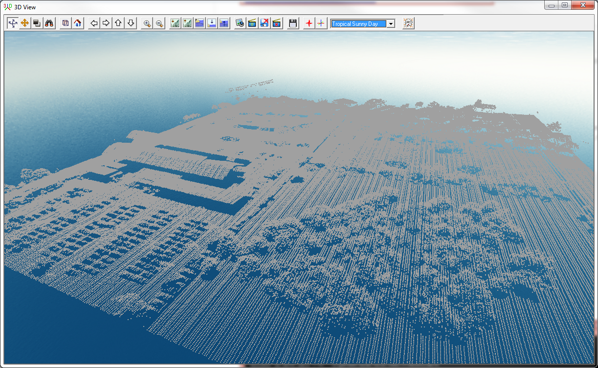
- Access to point cloud files containing a billion points or more
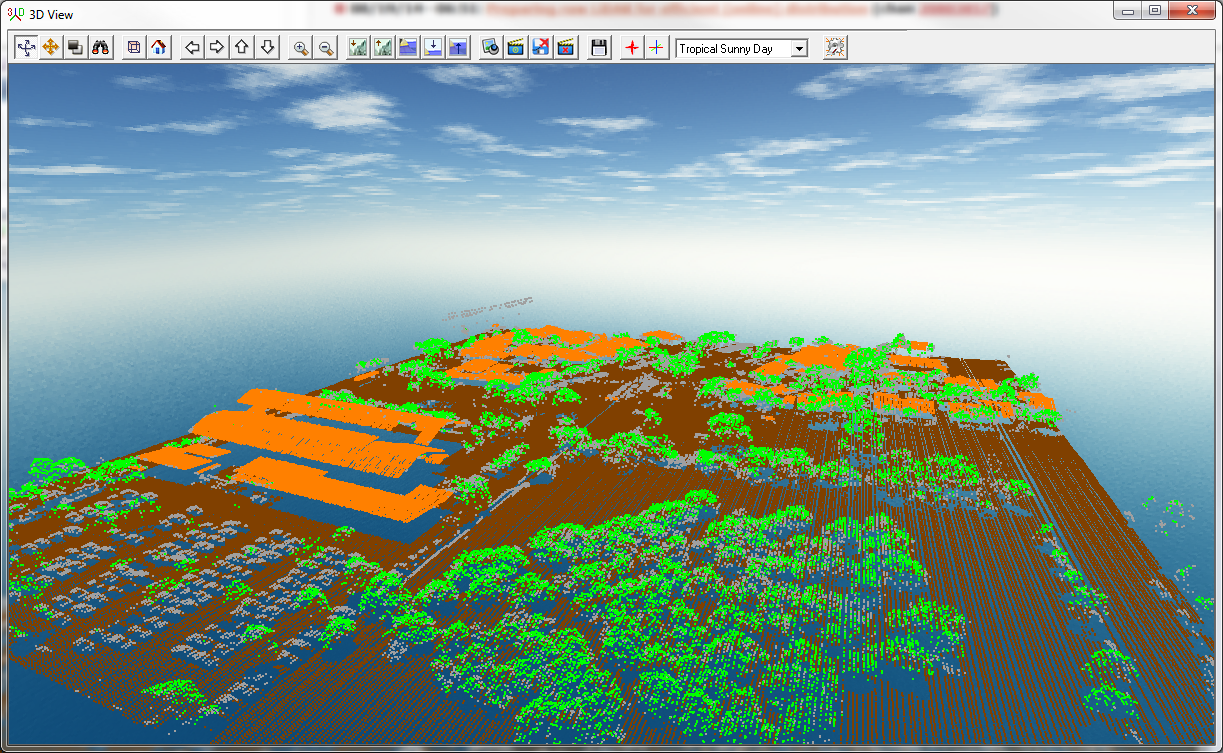
- Automatic point classification tools that automatically distinguish building, ground, vegetation and power lines and above-ground utility cables in unclassified layers
- Feature extraction functionality to automatically create 3D building footprints, trees and power lines
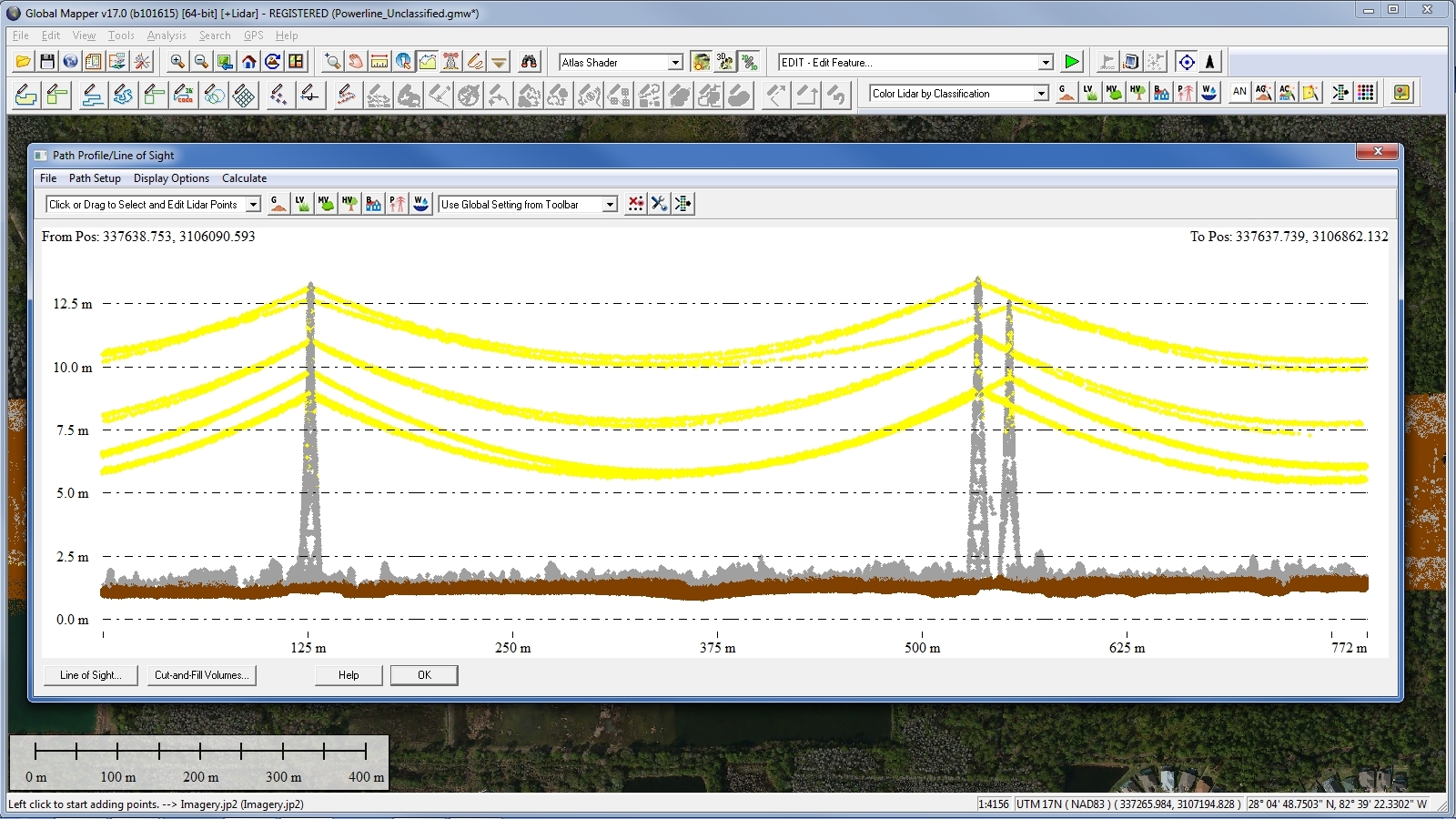
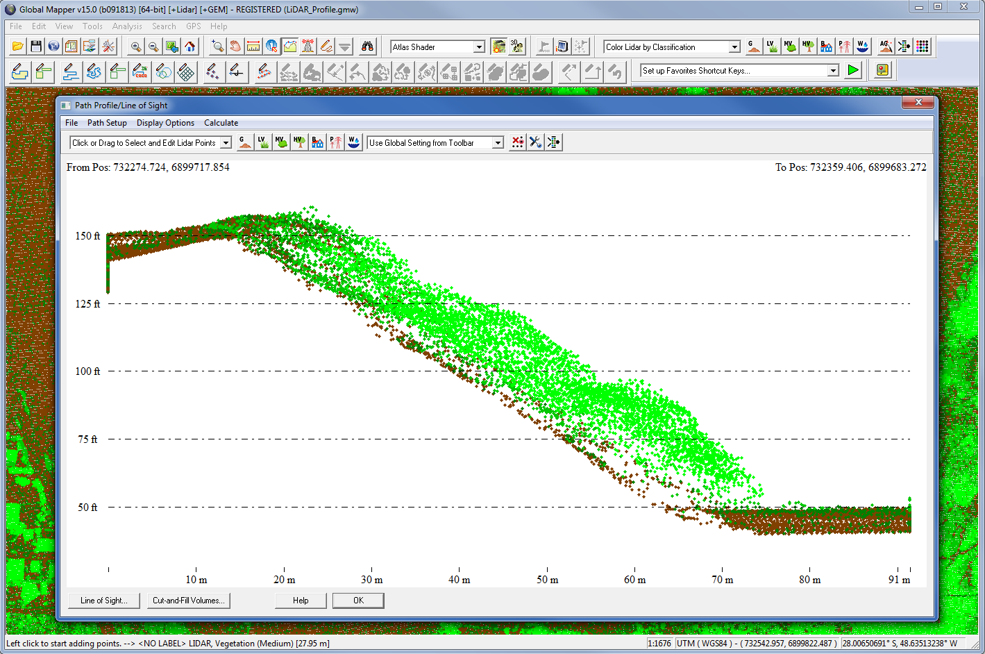
- Cross-sectional rendering using Global Mapper's Path Profile tool for viewing and editing the point cloud in a vertical perspective
- 3D Digitizing or custom feature extraction using the perpendicular profile function
- Advanced filtering options to efficiently remove erroneous or unneeded points
- Customizable detection and reclassification of noise points
- LiDAR scripting commands for streamlining workflow
- Point colorization from underlying imagery or gridded layer
- A LiDAR QC tool for correcting point cloud elevations using ground control points
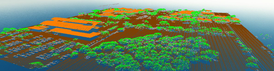
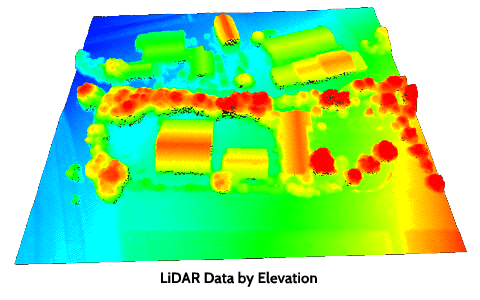
- Multiple point cloud visualization options including by classification, intensity, elevation, RGB, and point density
- Support for reporting LiDAR statistics
- Support for importing and exporting most common point cloud formats
- Support for NIR (near-infrared) point attributes with the option to create a NDVI or NDWI grid
- LiDAR sorting optimization to improve display and analysis speed.