- +91 9503666660 / 9823123633
- ☰
- Home
- About Us
-
Products
Global Mapper Global Mapper Pro Digital Elevation Data Drone/UAV Agisoft Metashape
(Formerly known as PhotoScan) Surfer GEO5EnviroInsiteGeographic Calculator GMS | SMS | WMS MAPublisher Geographic Imager Final Builder- Services
- Contact
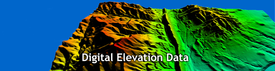
Digital Elevation Data

WEB Based application for Risk Assessment Analysis due to Natural Catastrophes like Flood, Fire & Landslides

Web-based application to manage and share Geospatial data
Schnell Informatics Pvt. Ltd is authorised distributor for Intermap's Digital Elevation Data and other Products in India
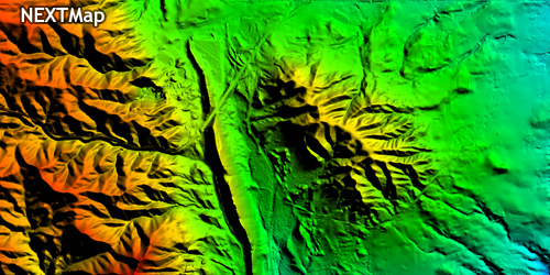

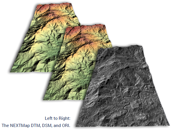
Intermap's Digital Elevation Data
Intermap's DEM products are 3D raster datasets with elevations captured at 5-meter postings or every 5 meters. They are generated using Intermap's STAR technology (Interferometric Synthetic Aperture Radar), which is mounted to an aircraft. The high-resolution NEXTMap database from Intermap Technologies® provides seamless, wide-area digital elevation data and images, collected using advanced technologies, to enable accurate geospatial analyses across the globe. Consisting of a digital surface model (DSM), digital terrain model (DTM), and orthorectified imagery (ORI), NEXTMap is ideal for everything from engineering and infrastructure to regional and national mapping.
These high-quality 3D digital mapping data meets the demanding needs of a wide range of market, such as:
- Defense and National Security
- Natural Resource Exploration
- Telecommunications
- Engineering and Infrastructure
- Risk Management
- Water Management
- Hydrological modeling
- Environmental management
- Route planning
- Tower siting
- Resource development
- Precision agriculture
- Forestry management
- Landslide prediction
- Propagation modeling
- Automotive
- Consumer electronics
NEXTMap products consist of seamless, wide-area, and current terrain information that is available in hundreds of projections, datums, and file formats.
DSM
A first-reflective-surface model that contains elevations of natural terrain features in addition to vegetation and cultural features such as buildings and roads.
- 10m posting
- Vertical accuracy of 1m RMSE (1.65m LE90), in unobstructed regions with slopes less than 10 degrees
DTM
A bare-earth model that contains elevations of natural terrain features such as barren ridge tops and river valleys. Elevations of vegetation and cultural features, such as buildings and roads, are digitally removed.
- 10m posting
- Vertical accuracy of 1m RMSE (1.65m LE90), in unobstructed regions with slopes less than 10 degrees
ORI
A grayscale radar image of the earth’s surface that has been corrected to remove geometric distortions caused by the terrain.
- 0.625m resolution
- Horizontal accuracy of 3m CE90 Left