
- +91 9503666660 / 9823123633
- ☰
- Home
- About Us
-
Products
Global Mapper Global Mapper Pro Digital Elevation Data Drone/UAV Agisoft Metashape
(Formerly known as PhotoScan) Surfer GEO5EnviroInsiteGeographic Calculator GMS | SMS | WMS MAPublisher Geographic Imager Final Builder- Services
- Contact
GIS in Government
Municipal CorporationWater ResourcesRoad NetworkPollution ControlForestryAgricultureAnimal HusbandryGIS in Agriculture
GIS and Remote Sensing have emerged as very significant information technology tools to boost the overall efficiency of agricultural sector. Various Governmental and semi-Governmental agencies are involved in research and development activities and comprehensive database for agricultural sector can ensure greater reliability of estimates and forecasting. This in turn can be used for effective agricultural planning and broad policy making.
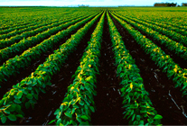
Efforts to improve and harness latest remote sensing and information technology techniques to capture, collate, add value and disseminate data into appropriate destinations will be helpful for managing risk and in accelerating the growth process of agricultural sector.
Geospatial analysis, the study of various geographic features, different weather conditions and the relationships that exist among these can be applied to many areas of the agricultural industry. By better understanding how features within the landscape interact, decision makers can optimize operational efficiency and improve economic returns. GIS is becoming fully integrated and widely accepted for helping government agencies to manage programs that support farmers and protect the environment.
GIS can be used effectively for –
- Cropping pattern monitoring
- Agricultural Planning and market analysis
- Soil Management
- Yield modeling and estimation
GIS in Municipal Corporation
The Trend of GIS application is shifting from an operational support tool to a strategic decision support system. Municipalities/Municipal corporations consist of various departments which deal with various utility services. For efficient and economical municipal administration, a comprehensive and integrated Geographic Information System has become essential.
Municipal corporations deal with enormous spatial as well as non-spatial data from various sources. Spatial data is available in the form of maps, satellite data and aerial photographs while non-spatial data is available as various reports, attribute information from various sources. Integrating this data over single common platform helps in analyzing the information as well as making some important decisions.
One major requirement of any municipal body is improvement of revenue through various techniques. The property mapping and utility mapping services assist municipal bodies in achieving higher revenue through better understanding with Geographic data overlay.
Schnell’s GIS services include–
- Satellite Image processing and registration
- Development Plan Geo-Registration
- Large scale mapping
- Utilities Mapping, database creation
- Ground truthing and attribute data collection through physical survey for tax department as well as for utilities
- Data integration and application development
GIS for Water Resources
Water is an important natural resource which is being used by individuals as well as institutions. It is very essential to manage this resource so as to assure proper distribution of it for everybody. GIS is a powerful tool for developing solutions for water resources such as assessing water quality and managing water resources on local and regional basis.
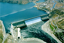
There are many water related agencies responsible for collecting various kind of data as well as validation of hydrological data. This data which is collected by various departments can be integrated through GIS and made it available with proper authentication for long term planning and management of water resources for its optimum utilization.
Schnell’s Water Resources related services include –
- Geospatial Database creation for –
- Watershed Management
- Flood Management
- Surface Water Management
- Groundwater Management
- Application development for Water Resources Data Management
- Creation of Digital Elevation Model for particular Region
- 3-D view generation and generation of slope aspect map
- Delineation of basin and sub basin
GIS for Road Network
India has one of the largest road networks in the world, second only to United States of America. Large number of infrastructure development projects are going on. Independent bodies like PMGSY are formed for special emphasis on roads in rural areas. There are central Government as well as State Government bodies which are constructing and maintaining road network in particular areas.
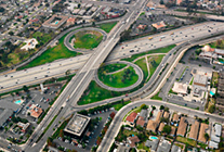
It has become very essential to manage the data of existing road network as well as proposed roads. GIS is one of the most important tools to manage this data. Data is available in spatial (hard copy of map) as well as non-spatial attribute form. With the help of GIS we can Geo-reference these maps and digitize road network.
After creation of geo-spatial database, we can perform various operations like calculating distance between any two points, performing shortest root analysis, querying for finding roads under construction, roads due for maintenance, finding details of contractors etc.
Schnell provide following services in this domain –
- Geo-Referencing and Digitization of Road Network
- Application development for Road Information management service
- Digital Elevation model creation for particular area and finding path profile for specific road section
- Finding out cut and fill volumes for some section of road
GIS in Forestry
GIS applications in forestry in India is the indispensable method by means of which the total forest area in India is measured. GIS technology deeply and positively impacts the way land managers, timber managers, and forestry specialists manage timber resources. Land managers increasingly turn to GIS for its analytic and visualization tools that allow them to analyze complex situations and make better-informed decisions.

GIS is becoming the foundation for new decision support tools used in all business processes of integrated forest management. The forest personnel in the field have to discharge police, magisterial and quasi judicial functions. In such conditions correct database helps the forest official to make better decisions.
Apart from database creation, the use of GIS can be extended to selection of sites for plantation, monitoring of encroachment at division level, regulation of burning , expansion of infrastructure and communication network, forest village management, personnel management, corridor planning for animal migration, survey and demarcation.
Another important area for application of this technology is forest -protection. Forests are shrinking very fast and the demand on the forest land is tremendous. Forest protection is a major challenge today. The GIS technology can be used very effectively to monitor the forest cover and locate the places where illegal activities are being carried out.
Thus GIS technology can play a very meaningful role in conservancy and sustainable use of natural resources.
GIS for Pollution Control
With rise in population and increase in vehicle numbers as well as industrial growth, new problems have emerged such as – Air Pollution & Water Pollution.
GIS for Air Pollution Control - Increasing number of vehicles is solely responsible for increasing air pollution levels in urban centers of the world. Besides CO2 emissions, significant quantities of CO, HC, NOx, SPM and other air toxins are emitted from these motor vehicles in the atmosphere, causing serious environmental and health impacts.
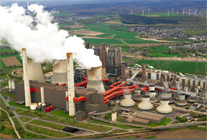
An effective air quality management system based on GIS provides the authorities with information about the current and likely future trends, throughout the area enabling them to make necessary assessments regarding the extent and type of the air pollution and control management strategies to be followed.
GIS for Water Pollution Control- Another area of concern is Water Pollution. Rivers, lakes, streams, and wetlands not only provide great natural beauty, they also supply the water necessary for drinking, recreation, industry, agriculture, and aquatic life.
GIS technology and scenario analysis can provide a good guidance to the synthesis, integrity and sustainability aspects for river basin water quality planning. The spatial databases of water environmental function region, pollution sources, monitoring sections and sewer outlets cab be built using GIS technology and carry out the detailed analysis.
GIS for Hazardous Waste Management - GIS applications are now being employed for effective hazardous waste management. Some State Pollution Control Boards are also adopting GIS tools to help hazardous waste generating companies find a location for setting up operations. Companies can track the amount of hazardous waste generated and thereby a route map can be generated to identify zones for disposal and also for recycling of waste.
GIS applications can also help in effective management of raw materials. The companies can know the exact amount of waste generated and the quantity available for waste disposal. Demographic maps are geo-referenced to know the exact location of these industries.
GIS in Animal Husbandry
GIS can prove to be very vital in Animal Husbandry Department. Animal Husbandry Department is actively involved in conservation and up-gradation of recognized breeds in the state. They are also carrying the responsibilities like training the farmers and professionals, Strengthening of semen stations, Organization of infertility camps, To deliver breeding inputs at farmers door steps, Supply of quality bulls used for NS, To setup strict quality control of services and inputs.
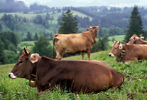
Using GIS complete livestock geo-database can be created. This can be very helpful in getting information about number of bulls, cows, poultry birds, buffaloes, milch animals in any village at a click of a button. Also Geo-database can be created for sheep breading farms for Exotic / Local / Cross Breed sheep within states, Locations of semen stations & frozen semen laboratories. Locations convenient to sheep rearing, Locations where cross breeding has been undertaken for upgradation oflocal sheep can be identified. Livestock Insurance Scheme is being implemented by Central Government in various states. Progress and extent of implementation can be integrated over spatial features using GIS.
Use of GIS for database creation of Artificial Insemination Centers – Today, the artificial insemination has become a normal method of breeding quality cattle. A large number of cows and buffaloes are inseminated artificially. The technique of artificial insemination is particularly more useful in a country like India where the paucity of quality sires has been the main hurdle in the way of cattle improvement. Geo-Database of these centers can be created using GIS technique. These centers can be displayed spatially.
- This spatial distribution of Artificial Insemination centers will give immediate idea about their distribution in complete state/nation.
- This will help to identify districts where number of such centers are less or almost none and special programme can be undertaken to increase the number.
- Distribution of future centers can be decided
- All the data related to each centers such as – Responsible authority, number and types of animals which are artificially inseminated, efficiency of center etc can be integrated with spatial location.