
- +91 9503666660 / 9823123633
- ☰
- Home
- About Us
-
Products
Global Mapper Global Mapper Pro Digital Elevation Data Drone/UAV Agisoft Metashape
(Formerly known as PhotoScan) Surfer GEO5EnviroInsiteGeographic Calculator GMS | SMS | WMS MAPublisher Geographic Imager Final Builder- Services
- Contact

Aquaveo LLC. Products
Schnell Informatics is the India Reseller of Aquaveo LLC. for its products
GMS - Groundwater Modeling System is the most intuitive and capable software platform used to create groundwater and subsurface simulations in a 3D environment.
GMS is the quickest and most intuitive groundwater modeling interface available. Construct a high level representation of the model using familiar GIS objects: points, arcs and polygons and easily update the model as needed.
Several types of models are supported and facilities are provided to share information between different models and data types. Tools are provided for site characterization, model conceptualization, mesh and grid generation, geostatistics, and post-processing.
GMS Conceptual Model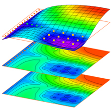
Modules
The interface for GMS is divided into eleven modules. A module is provided for each of the basic data types supported by GMS. As you switch from one module to another module, the Dynamic Tool Palette and the Menus change. This allows you to focus only on the tools and commands related to the data type you wish to use in the modeling process. Switching from one module to another can be done instantaneously to facilitate the simultaneous use of several data types when necessary. The following modules are supported in GMS:
 TIN Module
 2D Mesh Module
 3D Mesh Module
 Map Module
 Borehole Module
  2D Grid Module
  3D Grid Module
  GIS Module
  Solid Module
  2D Scatter Point Module
  3D Scatter Point Module
 Numerical Models
Numerical models are programs that are separate from GMS that are used to run an analysis on a model. The models can be built in GMS, and then run through the numerical model program. GMS can then read in and display the results of the analysis.
With most numerical models, GMS has the option of using a Model Wrapper to run the model and display real-time results during the model simulation.
The following numerical models are currently supported in GMS.
GMS Module
3D Grid
Map Module
2D Mesh
3D Mesh
Model Name
- MODFLOW
- MODPATH
- MT3DMS
- RT3D
- ART3D
- SEAM3D
- UTCHEM
- PEST
- SEAWAT
- MODAEM
- UTEXAS
SEEP2D
FEMWATER
SMS ( Surface-water Modeling System, Hydrogeology Software ) - The Complete Modeling Solution
SMS offers the complete solution for efficiently managing the entire surface-water modeling process. softwareAquaveo pioneered the conceptual model approach. Build a conceptual model in SMS by constructing a high level representation of the model using familiar GIS objects: points, arcs and polygons. Work with large, complex models in a simple and efficient manner by using the conceptual modeling approach and easily update or change the model as needed.
SMS also has powerful tools to build meshes and grids.
Modules in SMS:
Mesh Module 3D Cartesian Grid Module GIS Module
  Particle Module
  Curvilinear Grid Module Scatter Module
  1D River Module
  Images Cartesian Grid Module Map Module
  1D Grid Module
 Many of the tools in SMS are generic. They are designed to facilitate the establishment and operation of numerical models of rivers, coasts, inlets, bays, estuaries, and lakes.
WMS - Watershed Modeling System
WMS offers state of the art tools to perform automated basin delineation and to compute important basin parameters such as area, slope and runoff distances. It also serves as a graphical user interface for several hydraulic and hydrologic models. With its management of coordinate systems, WMS is capable of displaying and overlaying data in real world coordinates. The program also provides many display tools for viewing terrain surfaces and exporting images for reports and presentations.
The distinguishing difference between WMS and other similar applications is its ability to manipulate digital terrain data for hydrologic model development within a GIS-based environment. WMS uses three primary data sources for model development:
- Geographic Information Systems (GIS) Vector Data
- Digital Elevation Models (DEMs) or Gridded Elevation Sets
- Triangulated Irregular Networks (TINs)
Modules in WMS:
 Terrain Data Module Map Module Hydraulic Modeling Introduction 2D Grid Module
  Drainage Module
  Hydrologic Modeling Module GIS Module 2D Scatter Point Module