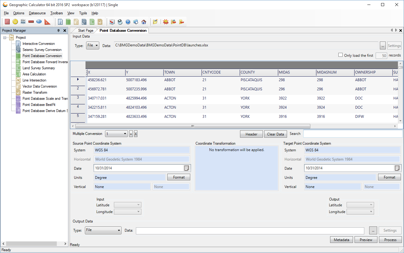
Schnell Informatics is the India Partner for Geographic Calculator Software by Blue Marble Geographics. Geographic Calculator (formerly Blue Marble Desktop) is a complete geospatial data conversion tool. It provides simple means of converting, translating and working with geospatial data. The application offers you the possibility to easily perform ‘Interactive’ , ‘Point Database’ , ‘Seismic Survey’ and ‘Vector Data’ conversions. The calculations can be inverse, best fit, scale and translate and derive datum shift.
Geographic Calculator displays a comprehensive interface which allows you to easily insert the data you have and extract the one you need. It offers you a project manager that you can use to organize your projects and share them.
Regardless of the data processing type, the steps required to obtain the results are basically the same. You select the input data, operation type and simply click the ‘Calculate’ button.
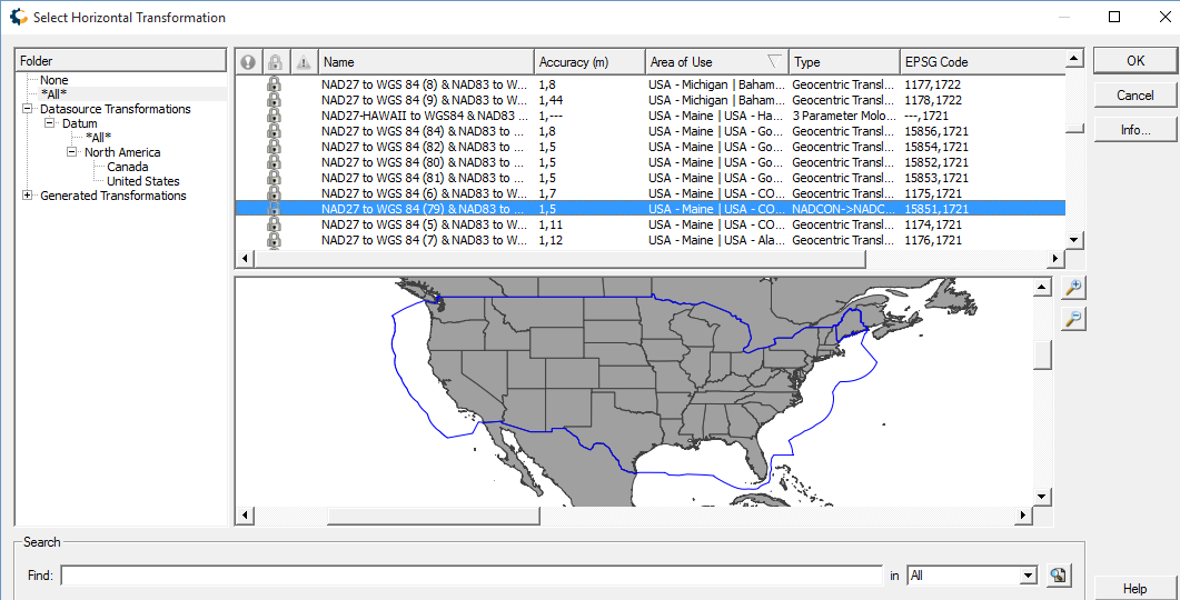
With this tool you are able to use major GIS formats such as GeoTIFF, Mapinfo Table, ESRI World (TFW, WLD, JGW), BMP, JPG2000, Enhanced Compressed Wavelet (ECW) and LizardTech's MrSID. You also get to edit geodetic data sources, import information from new ones or export it to XML format with the use of a large number of data source commands.
Geographic Calculator enables you to edit and convert SEG, SPS and UKOOA files. The applications is built to take in consideration large and complex data processing cases and is capable of saving you hours of calculation time. To make sure everything is in order, Geographic Calculator offers the use of a viewer which allows you to check the data prior to conversion.
Today the tool provides a single platform for highly accurate coordinate transformation of virtually any type of geospatial data and includes features such as:
- Support for reading and writing Coordinate Systems and Transformations to and from Petrel™ CTL files
- Access to the new GeoCalc Geodetic Registry, a cloud-based hosted library of geodetic parameters
- Support for Windows 10 machines and improved installation process
- XML-based geodetic parameter library
- Project Manager for data processing, jobs, and workflow management
- Start Page offering a user-friendly introduction to the key features and functions
- Administrative Tools to customize the datasource and restrict editing access
- Unmatched Geoid or Vertical Datum support, including VDatum support
- Powerful Survey Seismic format support
- Raster Geo-referencing, Reprojecting, and Vector File Translation Tools
- The ability to customize and send all or part of your GeoCalc datasource to Global Mapper
- Esri Extension and powerful CAD support
This all-in-one interface enables users to complete a number of geodetic and geospatial transformation functions on various types of data in the same interface. The enterprise collaboration tools such as workspaces and network folders enable consistency for highly accurate data translation across your organization.